
The #1 App for Agricultural Fence Building
Plan. Map. Estimate. Build.
All from the most advanced fence building software in the industry.
Ag Fence Pro gives professional fencing contractors the power to design, map, and manage projects with unmatched accuracy. High-resolution satellite imagery. Precision drawing tools. Advanced GPS tracking. Built specifically for agricultural fencing, not adapted from generic mapping apps.
Built for Real Fence Builders
Most mapping apps weren’t designed for agricultural fencing. Ag Fence Pro was.
If you’re tired of:
Guessing distances
Manually calculating materials
Switching between tools
Losing project details in the field
This is your upgrade.
Ag Fence Pro brings everything together in one powerful, cloud-based platform designed to support real-world fence construction, from planning to completion.
Powerful Features. Built for the Field.
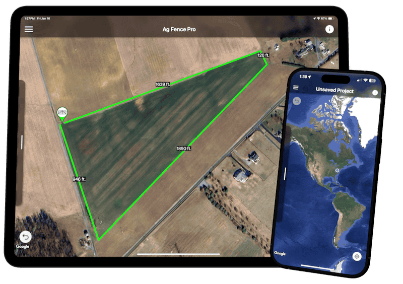
High-Definition Satellite Imagery
Plan and estimate with confidence using crisp, high-resolution satellite imagery powered by Google Maps.
Zoom in to see terrain, property features, and fence lines in exceptional detail. Every measurement starts with a clearer view of the land.
Better imagery = better planning = better estimates.
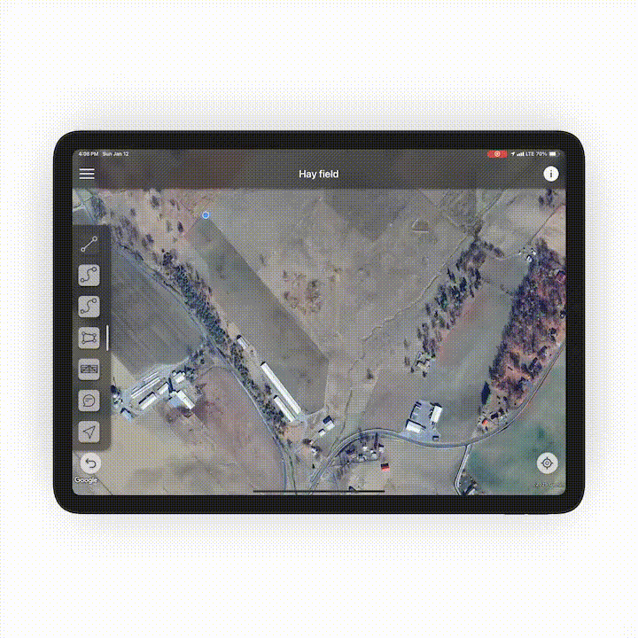
Accurate Mapping Tools
Design complete fence layouts with tools built specifically for agricultural fencing.
Draw fence lines and boundaries
Add gates and braces inline
Drop comments anywhere on the map
Every detail stays organized and easy to understand, for you and your team.
GIS Land Boundaries
Know exactly where you’re building.
Built-in GIS land boundaries ensure your plans stay within property lines and help avoid costly mistakes. Perfect for large agricultural properties and complex layouts.
Advanced GPS Tracking
Turn on GPS and map as you move.
Track paths, measure distances in real time, and capture accurate layouts while you’re on-site. No guesswork. No backtracking.
This is GPS fence mapping designed for real-world conditions.
Customer & Project Management
Manage customers, projects, and teams from one secure platform.
Cloud-based access
Automatic project saving
Team collaboration anywhere
Your work is always saved. Your team is always aligned.
Ag Fence Pro vs The Alternatives
Why professionals choose Ag Fence Pro over Google Earth or hunting apps:
Simple, Transparent Pricing
Free Plan
Free
Perfect for getting started.
Access core mapping features
Explore the platform
No credit card required
Pro Plan
$49.99/mo
Everything you need to run fencing projects professionally.
Full access to all features
Advanced GPS tracking
GIS land boundaries
Customer & project management
Cloud-based collaboration
Designed for Mobile. Built for Speed.
Ag Fence Pro is optimized for mobile-first workflows.
Fast load times
Clean, touch-friendly controls
Easy navigation in the field
Plan on-site. Adjust instantly. Never lose progress.
Fence Smarter Starting Today
Ag Fence Pro is the best app for fence building professionals who demand accuracy, speed, and reliability.